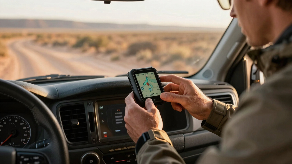

Choosing the best off-road GPS for overlanding in 2026 involves balancing rugged durability, detailed mapping, communication features, and ease of use. The Garmin Tread® 2 SxS Edition stands out for its high-resolution 8-inch display and rugged build, perfect for intense off-road rides. The Garmin Montana 700 offers versatile handheld navigation with routable maps, ideal for on-foot adventures. Meanwhile, the Garmin Tread Overland Edition adds satellite communication and group tracking for multi-rider trips. Each of these options trades some features for others—such as screen size versus portability or communication capabilities versus simplicity—so understanding their roles helps in making the right choice.
Key Takeaways
- The Garmin Tread 2 SxS Edition excels in durability and detailed trail mapping, ideal for rugged vehicle-based overlanding.
- Montana 700 offers versatility for multi-sport use, especially suited for hikers, bikers, and kayakers needing routable maps.
- Tread Overland combines navigation with satellite communication, perfect for group overlanding and remote communication.
- Size and weight vary significantly, influencing suitability for handheld use versus dashboard mounting.
- Tradeoffs often involve complex features versus user-friendly interfaces, so clarity about your primary needs is essential.
| Garmin Tread® 2 – SxS Edition, Rugged 8-inch Powersport Navigator for Thrilling Off-Road Rides |  | Best Overall Off-Road GPS for Vehicle Overlanding | Screen Size: 8 inches | Water Resistance: IP67 | Map Content: OpenStreetMap, USFS, Adventure Roads | VIEW LATEST PRICE | See Our Full Breakdown |
| Garmin Tread Powersport Off-Road Navigator with Group Ride Radio, Group Tracking and Voice Communication, 5.5″ Display, 010-02406-00 (Renewed) |  | Best for Group Overlanding with Communication | Display Size: 5.5 inches | Water Resistance: IPX7 | Map Content: North America, USFS, Satellite Imagery | VIEW LATEST PRICE | See Our Full Breakdown |
| Garmin Montana 700, Rugged GPS Handheld, Routable Mapping for Roads and Trails, Glove-Friendly 5″ Color Touchscreen |  | Best Handheld Rugged GPS for On-Foot Adventures | Screen Size: 5 inches | Water Resistance: MIL-STD 810 | Map Content: TopoActive, routable roads & trails | VIEW LATEST PRICE | See Our Full Breakdown |
| Garmin Tread Overland, All-Terrain Navigator, Rugged, Built in Mapping, iOverlander, Ultrabright Display |  | Best for Overlanding with Built-in Maps and Off-Road Features | Screen Size: 8 inches | Water Resistance: IP67 | Map Content: Topography, USFS, iOverlander | VIEW LATEST PRICE | See Our Full Breakdown |
| Garmin 010-02256-00 eTrex 22x, Rugged Handheld GPS Navigator, Black/Navy |  | Best Budget Rugged Handheld for Basic Overlanding | Screen Size: 2.2 inches | Water Resistance: MIL-STD 810 | Map Content: TopoActive, routable roads & trails | VIEW LATEST PRICE | See Our Full Breakdown |
More Details on Our Top Picks
Garmin Tread® 2 – SxS Edition, Rugged 8-inch Powersport Navigator for Thrilling Off-Road Rides
This model is distinguished by its large, high-resolution 8-inch display, making it ideal for vehicle-based overlanding where visibility matters. Its rugged IP67 rating and glove-friendly touchscreen ensure reliable operation in extreme weather and rough terrain. Unlike smaller handhelds, it offers turn-by-turn trail navigation with OpenStreetMap, U.S. Forest Service maps, and Adventure Roads content, making it perfect for unpaved adventures. However, its size limits portability for on-foot use, and map data limitations may occasionally require supplementary navigation tools. The preloaded satellite imagery and private land info make it a top pick for serious off-road enthusiasts.
Pros:- Large, high-resolution 8-inch touchscreen
- Rugged IP67 dust/water resistance
- Preloaded with detailed topographic maps and satellite imagery
- Supports private and public land info, campgrounds
Cons:- Size limits portability for hand-held use
- Some map data may be limited or require updates
- Higher price point due to advanced features
Best for: Vehicle-based overlanding on rugged trails with a need for detailed maps and durable design.
Not ideal for: Hikers or bikers seeking lightweight, portable navigation with simple interfaces.
- Screen Size:8 inches
- Water Resistance:IP67
- Map Content:OpenStreetMap, USFS, Adventure Roads
- Satellite Imagery:Downloadable
- Battery Life:Variable, supports external power
- Connectivity:Wi-Fi, Bluetooth
Bottom line: A robust, detailed navigation system perfect for overlanders who prioritize durability and map detail over portability.
Garmin Tread Powersport Off-Road Navigator with Group Ride Radio, Group Tracking and Voice Communication, 5.5″ Display, 010-02406-00 (Renewed)
This rugged 5.5-inch touchscreen is designed for riders who want connectivity alongside navigation. Its preloaded topographic and street maps of North America, including U.S. Forest Service trails, make it suitable for multi-rider adventures. The standout feature is the Group Ride Radio, enabling push-to-talk communication and group tracking for up to 20 riders—crucial for coordinated overlanding trips. Its durability and satellite connectivity support global communication via paired satellite devices. The main tradeoff is the slightly smaller display compared to larger units, which can be less ideal for detailed map viewing in complex terrains. Still, the integrated communication makes it a favorite for group explorers.
Pros:- Supports group ride radio and tracking for up to 20 riders
- Preloaded North America maps, including USFS trails
- Rugged IPX7 weather resistance
- Supports satellite communication via paired inReach devices
Cons:- Smaller 5.5-inch display limits detailed map viewing
- Renewed condition may affect warranty
- Requires satellite subscription for global communication
Best for: Overlanding groups needing reliable communication and group tracking capabilities.
Not ideal for: Solo travelers or those seeking the largest possible display for detailed navigation.
- Display Size:5.5 inches
- Water Resistance:IPX7
- Map Content:North America, USFS, Satellite Imagery
- Group Tracking:Yes, up to 20 riders
- Communication:Group Ride Radio, Pairing with satellite devices
- Battery Life:Variable, supports external power
Bottom line: Ideal for groups who prioritize communication and group coordination during overlanding trips.
Garmin Montana 700, Rugged GPS Handheld, Routable Mapping for Roads and Trails, Glove-Friendly 5″ Color Touchscreen
The Montana 700 is a versatile handheld GPS designed for outdoor explorers who need durability and detailed mapping. Its 5-inch glove-friendly color touchscreen offers easy viewing, and its rugged MIL-STD 810 rating ensures it withstands shocks, water, and extreme temperatures. The device supports multiple GNSS systems (GPS, GLONASS, Galileo), extending its usability in challenging environments. Preloaded TopoActive maps with routable roads and trails make it excellent for hiking, biking, or kayaking. Its multi-sensor suite includes an altimeter, compass, and barometer, providing comprehensive navigation data. The main tradeoff is its size—more portable but less suited for vehicle mounting or large screen navigation.
Pros:- Rugged MIL-STD 810 rated construction
- Supports GPS, GLONASS, Galileo for challenging environments
- Preloaded TopoActive maps with routable roads and trails
- Glove-friendly 5-inch touchscreen
Cons:- Limited screen size for detailed trail views
- Battery life up to 25 hours, may require extra batteries
- Not as feature-rich for satellite imagery or group communication
Best for: Hikers, bikers, kayakers, and outdoor enthusiasts needing a rugged handheld with detailed maps.
Not ideal for: Vehicle-based overlanding where a large, dashboard-mounted GPS is preferred.
- Screen Size:5 inches
- Water Resistance:MIL-STD 810
- Map Content:TopoActive, routable roads & trails
- Satellite Support:GPS, GLONASS, Galileo
- Battery Life:Up to 25 hours
- Connectivity:Supported via USB, optional Bluetooth
Bottom line: Best suited for individual outdoor adventurers who need rugged, detailed navigation in challenging terrains.
Garmin Tread Overland, All-Terrain Navigator, Rugged, Built in Mapping, iOverlander, Ultrabright Display
The Tread Overland Edition offers an 8-inch ultrabright display with preloaded topography, USFS land info, and iOverlander POIs, making it ideal for vehicle-based exploration. Its rugged design with IP67 rating and built-in inReach satellite communication supports remote communication and SOS features, critical for overlanders venturing into isolated areas. Support for vehicle-specific features like digital switches and compatibility with Garmin’s group tracking enhances multi-rider coordination. The main tradeoff is its size, which makes it less portable but excellent for dashboard mounting. It balances detailed navigation with satellite communication for remote expeditions.
Pros:- Built-in topography and USFS land data
- Ultrabright 8-inch touchscreen display
- Supports inReach satellite communication and SOS
- Preloaded with iOverlander points of interest
Cons:- Bulkier size limits portability
- Requires subscription for satellite features
- Higher cost compared to simpler GPS units
Best for: Overlanders seeking a rugged, all-in-one navigation and communication system for vehicle use.
Not ideal for: Solo hikers or bikers who prefer lightweight handheld devices without vehicle-specific features.
- Screen Size:8 inches
- Water Resistance:IP67
- Map Content:Topography, USFS, iOverlander
- Satellite Communication:inReach, SOS
- Connectivity:Wi-Fi, Bluetooth
- Battery Life:Variable, supports external power
Bottom line: Excellent for overlanding groups needing rugged navigation combined with satellite communication and vehicle integration.
Garmin 010-02256-00 eTrex 22x, Rugged Handheld GPS Navigator, Black/Navy
The eTrex 22x offers a compact, rugged design with a sunlight-readable 2.2-inch display, supporting routable Topo Active maps for roads and trails. Its dual support for GPS and GLONASS means better performance in challenging environments. While its smaller size and basic interface are advantageous for portability and ease of use, it lacks advanced features like satellite imagery or group communication. The device is highly rated for durability and reliable navigation, but its limited screen size makes it less suitable for detailed map viewing in complex terrains. It’s a cost-effective choice for entry-level overlanders.
Pros:- Rugged construction, MIL-STD 810 rated
- Supports GPS and GLONASS for challenging environments
- Preloaded Topo Active maps with routable roads and trails
- Small, lightweight, easy to carry
Cons:- Limited display size (2.2 inches)
- No touch interface; uses buttons only
- Shorter battery life in demanding conditions
Best for: Budget-conscious overlanders who need reliable, durable navigation for basic off-road use.
Not ideal for: Advanced users needing detailed maps, satellite imagery, or communication features.
- Screen Size:2.2 inches
- Water Resistance:MIL-STD 810
- Map Content:TopoActive, routable roads & trails
- Satellite Support:GPS, GLONASS
- Battery Life:Up to 25 hours
- Connectivity:USB, optional ANT+
Bottom line: Best for budget-minded adventurers needing dependable navigation without extra bells and whistles.

How We Picked
Our selection process focused on ruggedness, map detail, communication features, and user interface tailored specifically for overlanding. We analyzed product specifications, user reviews, and expert insights to identify GPS units that excel in harsh environments and provide reliable navigation on unpaved terrains. We prioritized devices that support preloaded topographic and trail maps, durable construction rated for extreme conditions, and additional features like satellite communication and group tracking. The models selected represent a range of use cases—from handheld off-road explorers to vehicle-mounted systems—ensuring that different overlanding needs are addressed.
Factors to Consider When Choosing Best Off Road Gps For Overlanding
When selecting an off-road GPS for overlanding, consider durability, map detail, communication features, and intended use. The right device depends on whether you prioritize vehicle-based navigation, handheld versatility, or group communication. Think about the environment—extreme weather, remote areas, or challenging terrains—as well as your typical trip length and group size. Compatibility with maps, ease of use, and extra features like satellite communication can make or break your experience in the field.
Durability and Ruggedness
Overlanding involves tough conditions like mud, dust, and water. Look for devices rated IP67 or IP68, MIL-STD 810, or similar rugged standards. These features ensure your device withstands shocks, water ingress, and extreme temperatures, keeping your navigation reliable no matter what terrain you encounter.
Mapping and Navigation
Preloaded topographic, trail, and land boundary maps are essential. Consider whether the device supports routable roads, trails, and satellite imagery. Larger screens improve visibility on vehicle dashboards, but handheld units offer portability for on-foot exploration. Compatibility with third-party maps can extend your options.
Communication and Group Features
Group tracking, two-way messaging, and satellite SOS features are critical for remote overlanding. Devices like the Garmin Tread Overland with inReach support global communication, while others focus solely on navigation. Match features with your trip’s complexity and group size.
Size, Battery, and Mounting
Size impacts portability versus ease of viewing. Larger units are often more rugged and easier to operate in vehicles, but less portable for on-foot use. Battery life varies widely; choose a device with sufficient runtime for your trip length. Mounting options should match your vehicle or backpack setup.
Price and Extra Features
Budget options like the eTrex 22x offer basic yet reliable navigation, while premium models include satellite imagery, inReach satellite communication, and advanced sensors. Decide which features are essential, and balance cost with your overlanding needs.
Frequently Asked Questions
What is the most durable GPS for overlanding?
The Garmin Montana 700 and Garmin Tread Overland Edition both feature rugged MIL-STD and IP ratings, making them highly resistant to shocks, water, and dust. Montana 700 is a handheld, while Tread Overland is vehicle-mounted, so choose based on your primary use. Both are designed to stand up to harsh conditions encountered in overlanding.
Which GPS offers the best mapping for off-road trails?
The Garmin Tread 2 SxS Edition and Tread Overland come preloaded with detailed topographic maps, trail data, and satellite imagery, making them excellent choices for off-road navigation. Montana 700 also provides routable topo maps, but the Tread series focuses more on trail-specific content and terrain visualization, which is crucial for overlanding.
Do these GPS units support group tracking and communication?
Yes, the Garmin Tread Overland and the Renewed Garmin Tread model support group tracking for up to 20 riders and include satellite communication options via inReach. The Montana 700 and eTrex 22x lack built-in communication features and are better suited for solo navigation or basic outdoor use.
Are handheld GPS units sufficient for vehicle overlanding?
Handheld GPS units like the Montana 700 and eTrex 22x are portable and rugged, perfect for on-foot exploration or backup navigation. However, for vehicle-based overlanding, larger, dashboard-mounted units like the Garmin Tread models offer better visibility, more comprehensive mapping, and easier integration with vehicle systems.
How important is satellite communication for overlanding GPS?
Satellite communication, available on the Garmin Tread Overland and newer Garmin Tread models, is vital for remote trips where cell service is unavailable. It enables two-way messaging, SOS alerts, and group coordination, significantly enhancing safety and logistical management during extended overland adventures.
Conclusion
For those who mainly drive in rugged, remote areas with a focus on durability and detailed trail maps, the Garmin Tread 2 SxS Edition offers excellent value. Overlanders prioritizing group coordination and satellite communication should consider the Garmin Tread Overland. Outdoor enthusiasts and hikers needing a portable, tough device will find the Montana 700 or eTrex 22x to be the best fit. Ultimately, your choice depends on whether your focus is vehicle navigation, group communication, or individual exploration—aligning the device’s strengths with your overlanding style will ensure a successful adventure in 2026.